alb4614071
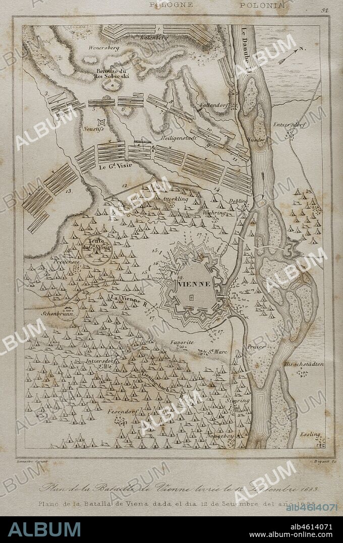
Holy Roman Empire. Plan of the Battle of Vienna, 12 September 1683. It took place at Kahlenberg Mountain, near Vienna, ather the city had been besieged by the Ottoman Empire during two months. The battle was fought by the Holy Roman Empire led by the Habsburg Monarchy, and the Polish-Lithuanian Commonwealth, both under the command of King John III Sobieski, against the Ottomans. The result was a victory for the first. Engraving by Lemaitre and Bigant. History of Poland, by Charles Foster. Panorama Universal, 1840.

|
Ajouter à une autre Lightbox |
|
Ajouter à une autre Lightbox |


Avez-vous déjà un compte? S'identifier
Vous n'avez pas de compte ? S'inscrire
Acheter cette image

Légende:
Voir la traduction automatique
Holy Roman Empire. Plan of the Battle of Vienna, 12 September 1683. It took place at Kahlenberg Mountain, near Vienna, ather the city had been besieged by the Ottoman Empire during two months. The battle was fought by the Holy Roman Empire led by the Habsburg Monarchy, and the Polish-Lithuanian Commonwealth, both under the command of King John III Sobieski, against the Ottomans. The result was a victory for the first. Engraving by Lemaitre and Bigant. History of Poland, by Charles Foster. Panorama Universal, 1840.
Personnalités:
Crédit:
Album / Prisma
Autorisations:
Modèle: Non - Propriété: Non
Questions sur les droits?
Questions sur les droits?
Taille de l'image:
3175 x 4783 px | 43.4 MB
Taille d'impression:
26.9 x 40.5 cm | 10.6 x 15.9 in (300 dpi)
Mots clés:
17E SIECLE • 17EME S • APRES-GUERRE: POLOGNE • ARMEE • ARMEE, TURQUE • ARMÉEE • ARMÉES • BATAILLE DU KAHLENBERG • BATAILLE • BATALLE • CAMP MILITAIRE • CAMPEMENT (ARMEE) • CARTE (GEOGRAPHIE) • CARTE GEOGRAPHIQUE • CARTE • CARTOGRAPHIE • CHARLES FOSTER • COMMUNISME: POLOGNE • CONFLICTS • CONFLIT • DANUBE, FLEUVE • DESSIN PLANS • DIX-SEPTIÈME SIÈCLE • DYNASTIE: HABSBOURG • EMPIRE OTTOMAN • EUROPE • EUROPÉEN • FLEUVE DANUBE • FLUVIALE • FRAVURE • GRAVURE • GUERRE SIEGE • GUERRE • HABSBOURG • HABSBOURG, MAISON DE • HISOIRE • HISTOIRE • MILITAIRE • PLAN (CARTOGRAPHIE) • PLANS • POLOGNE • POLOGNE, COMMUNISME • POLONAIS • POLONIAS • SAINTE LIGUE • SCIENCE: CARTOGRAPHIE • SIEGE (GUERRE) • SIEGE (MILITAIRE) • SIEGE • STRATEGIE • TROUPES MILITAIRES • TURC • TURCS • TURQUE • VIE MILITAIRE ET ARMEMENT • XIXE SIÈCLE • XVIIE SIECLE
 Pinterest
 Twitter
 Facebook
 Copier le lien
 Email
Email
