alb9514006
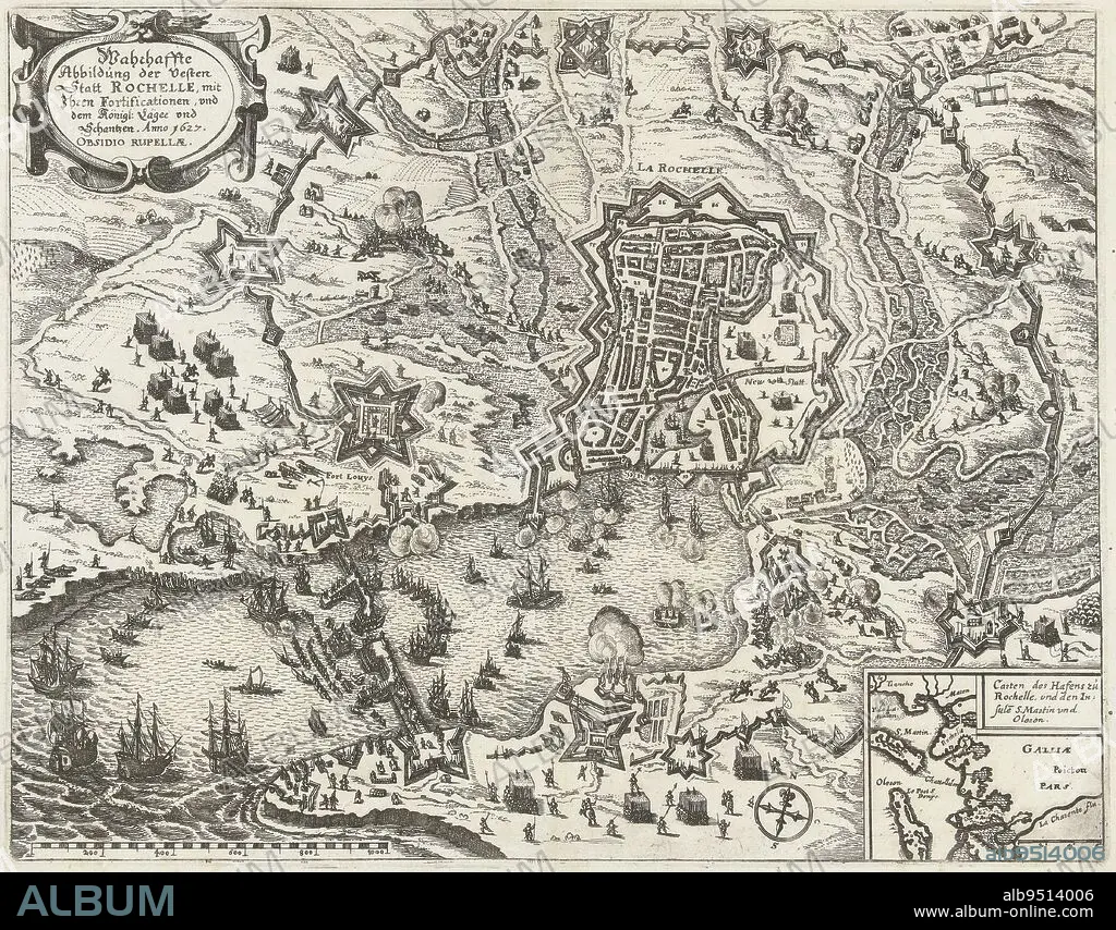
Map of the French coast showing the siege of La Rochelle by the State army and France, September 1627 - October 1628 Surrounding the rebellious city by the French royal troops under Cardinal Richelieu Bottom right an inset with a map of the greater area, Map of the Siege of La Rochelle, 1627-1628 Wahrhaffte Abbildung der Vesten Statt Rochelle, mit Ihren Fortificationen, und dem Knigl: Lger und Schantzen Anno 1627 Obsidio Ruppellae , print maker: anonymous, Claes Jansz. Visscher (II), (workshop of), Germany, 1627 - 1629, paper, etching, h 274 mm × w 350 mm.
| Partager |
|---|
 Pinterest Pinterest |
 Twitter Twitter |
 Facebook Facebook |
 Copier le lien Copier le lien |
 Email Email |
|
Ajouter à une autre Lightbox |
|
Ajouter à une autre Lightbox |


Avez-vous déjà un compte? S'identifier
Vous n'avez pas de compte ? S'inscrire
Acheter cette image

Légende:
Voir la traduction automatique
Map of the French coast showing the siege of La Rochelle by the State army and France, September 1627 - October 1628 Surrounding the rebellious city by the French royal troops under Cardinal Richelieu Bottom right an inset with a map of the greater area, Map of the Siege of La Rochelle, 1627-1628 Wahrhaffte Abbildung der Vesten Statt Rochelle, mit Ihren Fortificationen, und dem Knigl: Lger und Schantzen Anno 1627 Obsidio Ruppellae , print maker: anonymous, Claes Jansz. Visscher (II), (workshop of), Germany, 1627 - 1629, paper, etching, h 274 mm × w 350 mm
Crédit:
Album / quintlox
Autorisations:
Modèle: Non - Propriété: Non
Questions sur les droits?
Questions sur les droits?
Taille de l'image:
4761 x 3722 px | 50.7 MB
Taille d'impression:
40.3 x 31.5 cm | 15.9 x 12.4 in (300 dpi)
Mots clés:
ALLEMAGNE • ATELIER • CARTE (GEOGRAPHIE) • CARTE GEOGRAPHIQUE • CARTE • DESSIN PLANS • FRANCE • PAPIER • PLAN (CARTOGRAPHIE) • PLANS
