alb4094254
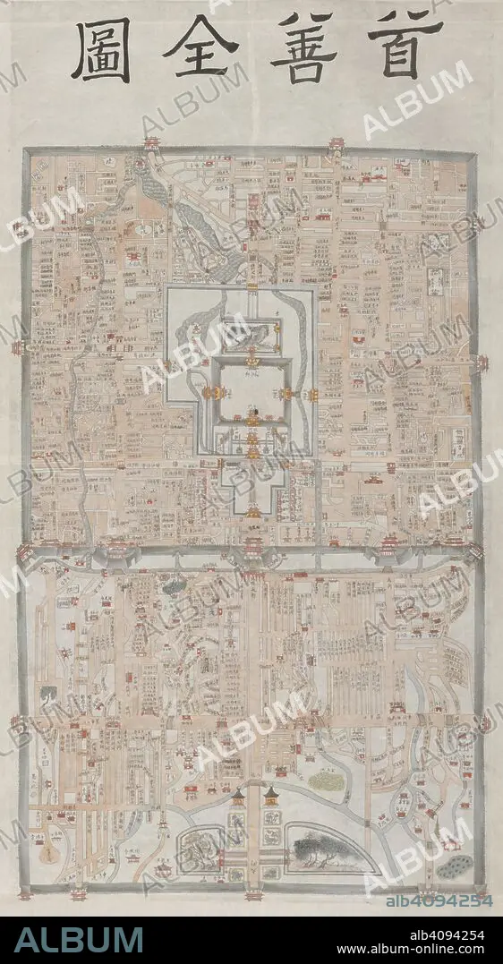
Peking. c.1800. This manuscript map of Peking appears to be based on a detailed survey carried out during the 18th century under the Ch'ing emperor Ch'ien-lung (r.1736-1796). The Imperial palace (the Forbidden City), is shown in the centre of the inner city. Originally published/produced in c.1800. . Source: Add. 22048,. Language: Chinese.
| Partager |
|---|
 Pinterest Pinterest |
 Twitter Twitter |
 Facebook Facebook |
 Copier le lien Copier le lien |
 Email Email |
|
Ajouter à une autre Lightbox |
|
Ajouter à une autre Lightbox |


Avez-vous déjà un compte? S'identifier
Vous n'avez pas de compte ? S'inscrire
Acheter cette image

Légende:
Voir la traduction automatique
Peking. c.1800. This manuscript map of Peking appears to be based on a detailed survey carried out during the 18th century under the Ch'ing emperor Ch'ien-lung (r.1736-1796). The Imperial palace (the Forbidden City), is shown in the centre of the inner city. Originally published/produced in c.1800. . Source: Add. 22048,. Language: Chinese.
Crédit:
Album / British Library
Autorisations:
Modèle: Non - Propriété: Non
Questions sur les droits?
Questions sur les droits?
Taille de l'image:
5376 x 9791 px | 150.6 MB
Taille d'impression:
45.5 x 82.9 cm | 17.9 x 32.6 in (300 dpi)
Mots clés:
ASIE • ASIE, CONTINENT • AUTOROUTE • BEIJING • BEIJING, CHINE • BEIJING, PAYSAGE, CHINE • CARREFOUR • CARTE (GEOGRAPHIE) • CARTE GEOGRAPHIQUE • CARTE • CARTOGRAPHIE • CHINE • CITE • CONTINENT ASIE • DESSIN PLANS • DISCIPLINE • HIGHWAY • INFRASTRUCTURE • PEKIN • PLAN (CARTOGRAPHIE) • PLANS • RUE • SCIENCE: CARTOGRAPHIE • SCIENCES HUMAINES • VILE • VILLE
