alb2119681
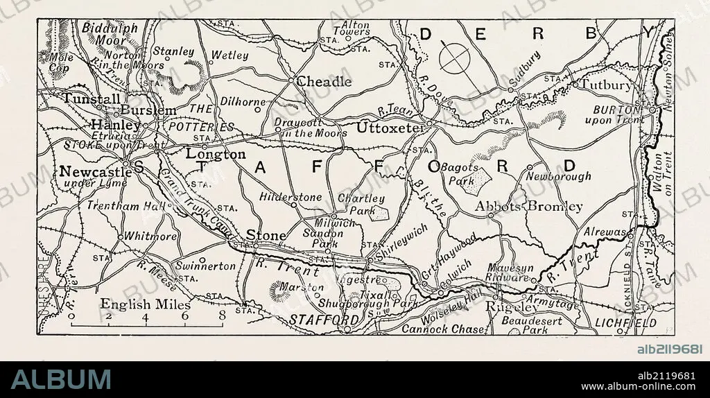
MAP OF THE TRENT, FROM THE SOURCE TO NEWTON SOLNEY, UK. The River Trent is one of the major rivers of England.
| Partager |
|---|
 Pinterest Pinterest |
 Twitter Twitter |
 Facebook Facebook |
 Copier le lien Copier le lien |
 Email Email |
|
Ajouter à une autre Lightbox |
|
Ajouter à une autre Lightbox |


Avez-vous déjà un compte? S'identifier
Vous n'avez pas de compte ? S'inscrire
Acheter cette image

Légende:
Voir la traduction automatique
MAP OF THE TRENT, FROM THE SOURCE TO NEWTON SOLNEY, UK. The River Trent is one of the major rivers of England.
Crédit:
Album / quintlox
Autorisations:
Modèle: Non - Propriété: Non
Questions sur les droits?
Questions sur les droits?
Taille de l'image:
4160 x 2118 px | 25.2 MB
Taille d'impression:
35.2 x 17.9 cm | 13.9 x 7.1 in (300 dpi)
Mots clés:
ANGLETARRE • ANGLETERE • ANGLETERRE • CARTE (GEOGRAPHIE) • CARTE GEOGRAPHIQUE • CARTE • DESSIN PLANS • FLEUVE • FLUVIALE • GRANDE BERTAGNE • GRANDE BRETAGNE • GRANDE-BRETAGNE • HISOIRE • HISTOIRE • INGLATERRA • MILLESIME • PLAN (CARTOGRAPHIE) • PLANS • RIO • RIVIÈRE FLEUVE • RIVIERE • RIVIRE • RIVIRE • ROYAUME UNI • ROYAUME-UNI • VICTORIEN • VICTORIENNE • XIXE SIÈCLE
