alb4188953
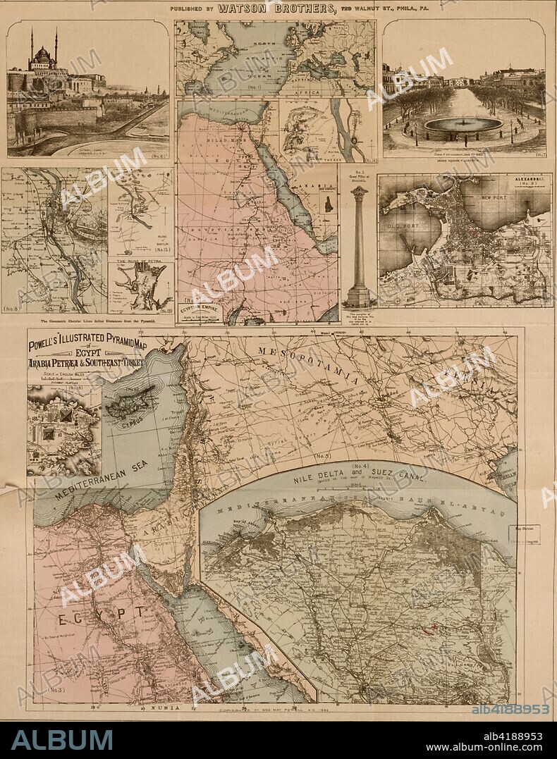
Egypt, Arabia Petræa, and Southeastern Turkey

|
Ajouter à une autre Lightbox |
|
Ajouter à une autre Lightbox |


Avez-vous déjà un compte? S'identifier
Vous n'avez pas de compte ? S'inscrire
Acheter cette image

Titre:
Egypt, Arabia Petræa, and Southeastern Turkey
Légende:
Voir la traduction automatique
Egypt, Arabia Petræa, and Southeastern Turkey : pyramid plateau, Cyprus and the delta; No. 1. General map from Missouri to Euphrates. -- No. 2. Egyptian Empire. -- No. 3. Powell's illustrated pyramid map of Egypt, Arabia Petræa and South-East Turkey. -- No. 4. Nile Delta and Suez Canal. -- No. 5. Great pillar at Alexandria. -- No. 6. Citadel, Cairo. -- No. 7. Grand Square, Alexandria. -- No. 8. Cairo. -- No. 9. Alexandria. -- No. 10. Pyramid plateau. -- No. 11. Cyprus. -- No. 12. Ruins of Babylon. -- No. 13. The ruins of Petra. -- No. 14. The ruins of Thebes.
Crédit:
Album / Universal Images Group / Universal History Archive/UIG
Autorisations:
Modèle: Non - Propriété: Non
Questions sur les droits?
Questions sur les droits?
Taille de l'image:
2778 x 3600 px | 28.6 MB
Taille d'impression:
23.5 x 30.5 cm | 9.3 x 12.0 in (300 dpi)
Mots clés:
AFRIQUE • ALEXANDRIE • BABYLONE • CAIRE • CAIRE, LE • CARTE (GEOGRAPHIE) • CARTE GEOGRAPHIQUE • CARTE • CARTOGRAPHIE • CHYPRE • DESSIN PLANS • EGYPTE • FLEUVE NIL • LA CAIRE • LE CAIRE • LE CAIRE, VUE • LECAIRE • NIL • NIL, FLEUVE • PLAN (CARTOGRAPHIE) • PLANS • SCIENCE: CARTOGRAPHIE • TURQUIE
 Pinterest
 Twitter
 Facebook
 Copier le lien
 Email
Email
