alb1512504
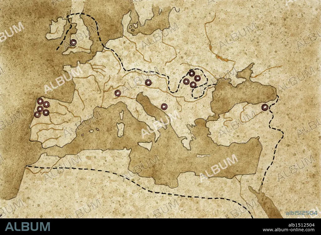
Ancient Rome. Map of Mediterranean Basin. Illustrated leading gold production centers. Color illustration.
| Partager |
|---|
 Pinterest Pinterest |
 Twitter Twitter |
 Facebook Facebook |
 Copier le lien Copier le lien |
 Email Email |
|
Ajouter à une autre Lightbox |
|
Ajouter à une autre Lightbox |


Avez-vous déjà un compte? S'identifier
Vous n'avez pas de compte ? S'inscrire
Acheter cette image

Légende:
Voir la traduction automatique
Ancient Rome. Map of Mediterranean Basin. Illustrated leading gold production centers. Color illustration
Crédit:
Album / DEA PICTURE LIBRARY
Autorisations:
Modèle: Non - Propriété: Non
Questions sur les droits?
Questions sur les droits?
Taille de l'image:
5093 x 3470 px | 50.6 MB
Taille d'impression:
43.1 x 29.4 cm | 17.0 x 11.6 in (300 dpi)
Mots clés:
CARTE (GEOGRAPHIE) • CARTE GEOGRAPHIQUE • CARTE • CARTOGRAPHIE • DESSIN PLANS • DESSIN • DESSINER • EUROPE • GEOGRAPHIE • HISOIRE • HISTOIRE • HORIZONTALE • INDUSTRIE • MÉDITERRANÉE • MINE D'OR • MOTIF • PLAN (CARTOGRAPHIE) • PLANS • SCIENCE: CARTOGRAPHIE • SEPARATION • TECHNIQUE: DESSIN • VUE AERIENNE
