alb4390577
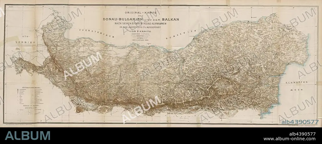
Original map of Danube-Bulgaria and the Balkans according to his own travel photographs taken in the years 1870-1874 by F. Kanitz, Map of the ethnologist Felix Philip Kanitz, Signed: Lith. U., Print by K. K. Hof- u., State Printing House, Fig. 121, p. 368, Kanitz, Felix Philipp (fec.); Kaiserlich-Königliche Hof- und Staatsdruckerei Wien (lith. u. gedr.), 1879, F. Kanitz: Donau-Bulgarien und der Balkan: historisch-geographisch-ethnographische Reisestudien aus den Jahren 1860-1879. Leipzig: Verlagsbuchhandlung von Hermann Fries, 1879-1880.
| Partager |
|---|
 Pinterest Pinterest |
 Twitter Twitter |
 Facebook Facebook |
 Copier le lien Copier le lien |
 Email Email |
|
Ajouter à une autre Lightbox |
|
Ajouter à une autre Lightbox |


Avez-vous déjà un compte? S'identifier
Vous n'avez pas de compte ? S'inscrire
Acheter cette image.
Sélectionnez l'usage:

Légende: Voir la traduction automatique
Original map of Danube-Bulgaria and the Balkans according to his own travel photographs taken in the years 1870-1874 by F. Kanitz, Map of the ethnologist Felix Philip Kanitz, Signed: Lith. U., Print by K. K. Hof- u., State Printing House, Fig. 121, p. 368, Kanitz, Felix Philipp (fec.); Kaiserlich-Königliche Hof- und Staatsdruckerei Wien (lith. u. gedr.), 1879, F. Kanitz: Donau-Bulgarien und der Balkan: historisch-geographisch-ethnographische Reisestudien aus den Jahren 1860-1879. Leipzig: Verlagsbuchhandlung von Hermann Fries, 1879-1880
Original map of Danube-Bulgaria and the Balkans according to his own travel photographs taken in the years 1870-1874 by F. Kanitz, Map of the ethnologist Felix Philip Kanitz, Signed: Lith. U., Print by K. K. Hof- u., State Printing House, Fig. 121, p. 368, Kanitz, Felix Philipp (fec.); Kaiserlich-Königliche Hof- und Staatsdruckerei Wien (lith. u. gedr.), 1879, F. Kanitz: Donau-Bulgarien und der Balkan: historisch-geographisch-ethnographische Reisestudien aus den Jahren 1860-1879. Leipzig: Verlagsbuchhandlung von Hermann Fries, 1879-1880
Crédit: Album / quintlox
Autorisations: ? Autorisation de modèle: Non - ? Autorisation de propriété: Non
Questions sur les droits?
Questions sur les droits?
Taille de l'image: 9000 × 3574 px | 92.0 MB
Taille d'impression: 76.2 × 30.3 cm | 3543.3 × 1407.1 in (300 dpi)
Mots clés: CARTE (GEOGRAPHIE) • CARTE GEOGRAPHIQUE • CARTE • DESSIN PLANS • EMPREINTE • PLAN (CARTOGRAPHIE) • PLANS
