alb5366846
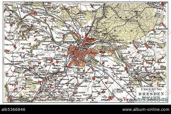
Map of Dresden and the surrounding area, Germany, Europe, end of the 19th Century, from Meyers Encyclopaedia, 1889, Europe.
| Partager |
|---|
 Pinterest Pinterest |
 Twitter Twitter |
 Facebook Facebook |
 Copier le lien Copier le lien |
 Email Email |
|
Ajouter à une autre Lightbox |
|
Ajouter à une autre Lightbox |


Avez-vous déjà un compte? S'identifier
Vous n'avez pas de compte ? S'inscrire
Acheter cette image

Légende:
Voir la traduction automatique
Map of Dresden and the surrounding area, Germany, Europe, end of the 19th Century, from Meyers Encyclopaedia, 1889, Europe
Crédit:
Album / ImageBroker / H.-D. Falkenstein
Autorisations:
Modèle: Non - Propriété: Non
Questions sur les droits?
Questions sur les droits?
Taille de l'image:
600 x 369 px | 648.6 KB
Taille d'impression:
5.1 x 3.1 cm | 2.0 x 1.2 in (300 dpi)
Mots clés:
CADRE • CARTE ROUTIERE • CARTE • CARTES • CARTON • ILLUSTRATION • IMAGES • INTERIEUR: TABLEAUX • PEINDRE • PEINTURE, SCENES D'INTERIE • SAXE • TABLEAU: SCENES D'INTERIEU • TABLEAUX
