alb1963307
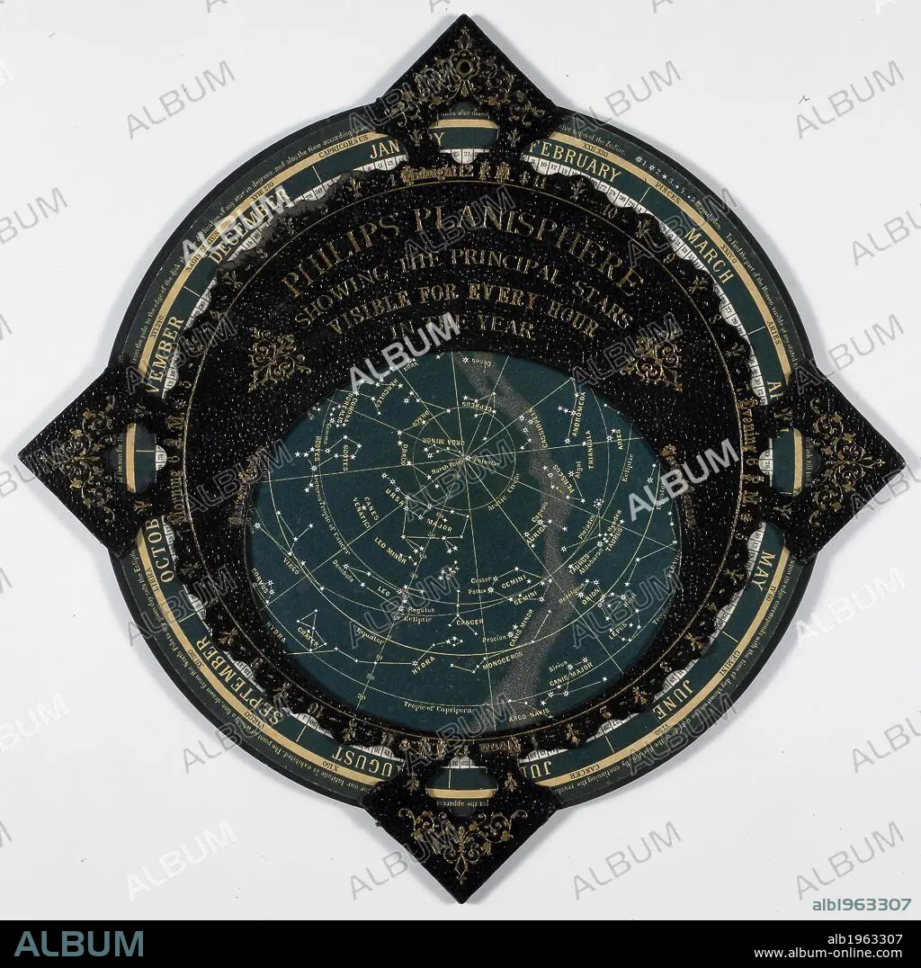
Philips Planisphere 1887. A map of the stars. . Philips’ Planisphere, showing the principal Stars visible for every hour in the year. London and Liverpool, England. Source: Maps 9.c.36. Language: English.
| Partager |
|---|
 Pinterest Pinterest |
 Twitter Twitter |
 Facebook Facebook |
 Copier le lien Copier le lien |
 Email Email |
|
Ajouter à une autre Lightbox |
|
Ajouter à une autre Lightbox |


Avez-vous déjà un compte? S'identifier
Vous n'avez pas de compte ? S'inscrire
Acheter cette image

Légende:
Voir la traduction automatique
Philips Planisphere 1887. A map of the stars. . Philips’ Planisphere, showing the principal Stars visible for every hour in the year. London and Liverpool, England. Source: Maps 9.c.36. Language: English.
Crédit:
Album / British Library
Autorisations:
Modèle: Non - Propriété: Non
Questions sur les droits?
Questions sur les droits?
Taille de l'image:
4018 x 4016 px | 46.2 MB
Taille d'impression:
34.0 x 34.0 cm | 13.4 x 13.4 in (300 dpi)
Mots clés:
ASTRE • ASTRONOMIE • CARTE (GEOGRAPHIE) • CARTE GEOGRAPHIQUE • CARTE • CARTOGRAPHIE • DESSIN PLANS • DOCUMENT • ETOILE • ILLUSTRATION • PLAN (CARTOGRAPHIE) • PLANS • SCIENCE DE LA NATURE • SCIENCE • SCIENCE: ASTRONOMIE • SCIENCE: CARTOGRAPHIE • SCIENCES PHYSIQUES ET NATURELLES • SCIENCES • SYSTEME SOLAIRE
